The Maryland Department of Natural Resources’ (MDNR) Chesapeake and Coastal Service (CCS) is pursuing opportunities to better align dredging and restoration projects to achieve financial and environmental benefits. However, there are currently fewer identified beneficial use placement sites than there are dredging projects, resulting in large amounts of dredged material being disposed of in the increasingly limited space of confined disposal facilities, which is increasing operational costs and curtaining restoration efforts for MDNR.
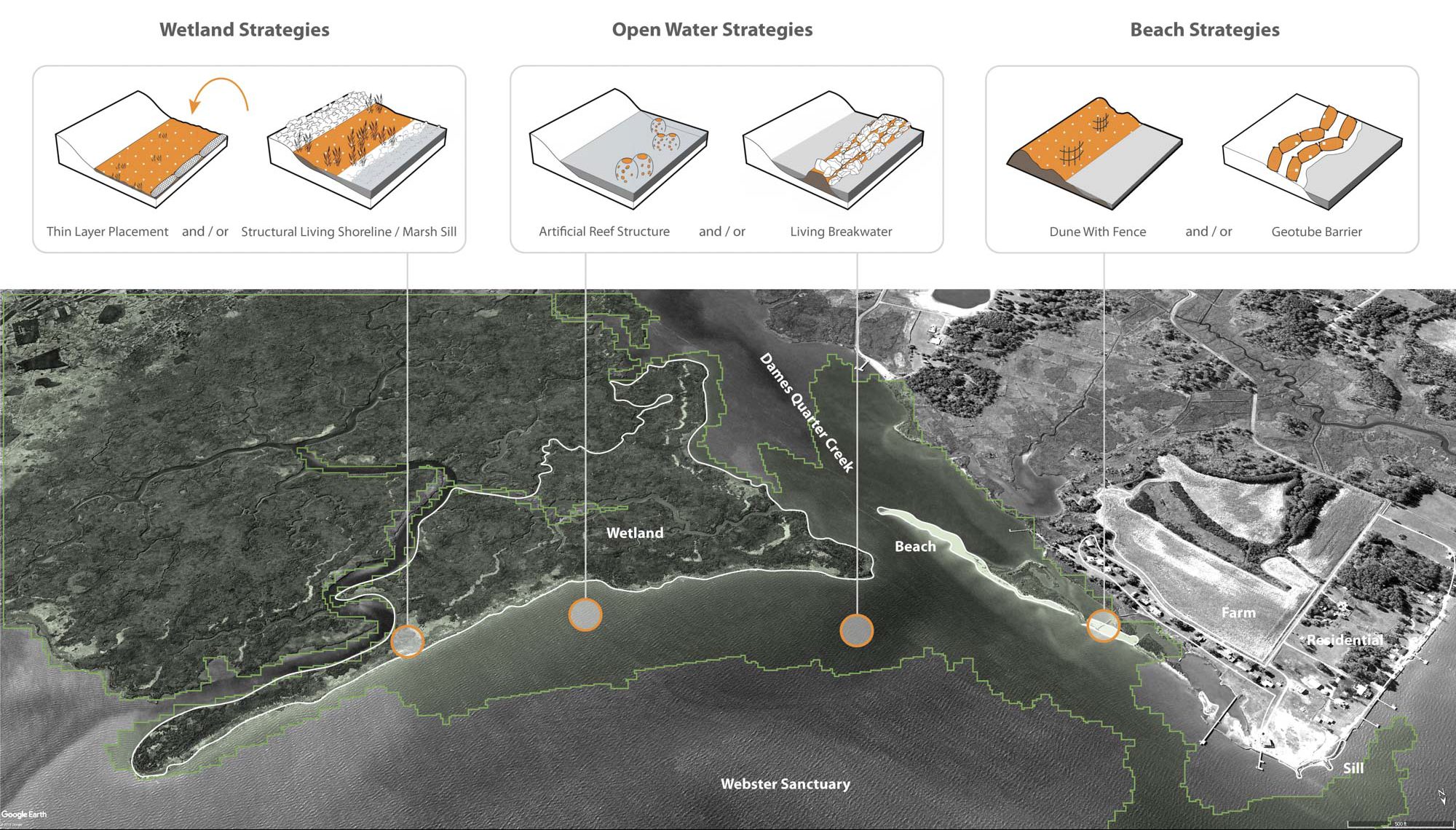
Mahan Rykiel Associates’ GIS Suitability Model & Analysis was used to identify potential beneficial use sites. The model integrated multiple selection criteria developed in coordination with MDNR CCS including dredging proximity, habitat protection, coastal flood risk reduction, and shoreline typology. Selection criteria and model outputs were weighted based on agency priorities, which can be adjusted to meet future needs as policies and/or other economic and environmental circumstances change.
Mahan Rykiel Associates used advanced data visualization techniques to develop maps, diagram, and orthographic projections to convey the quantitative analysis and characterization in a detailed project report that is being used by MDNR to guide its dredging and restoration programs in the Chesapeake Bay.