Ellicott City is an historic community in Howard County, Maryland, located at the confluence of multiple tributaries that feed into the Patapsco River. Notable for its connections to the National Road, the original B&O Railroad line and rich mill heritage, the unincorporated town dates to 1772. The community is a regional tourism destination, a center for entrepreneurial endeavors, and a nationally significant historic district, with much of its original architecture intact.
On July 30, 2016, Ellicott City experienced devastating flooding when nearly six inches of rain fell within two hours. While Ellicott City has experienced many floods throughout its 250-year history, the destruction caused by the 2016 flood—which displaced hundreds of residents, killed two people, significantly damaged dozens of businesses and cost millions of dollars in damage—was the worst in recent memory. Following the 2016 flood, the County’s overarching goal was to return Ellicott City to normalcy as quickly and affordably as possible. During the recovery phase, there was no master plan or guiding document for Ellicott City that could be looked at for rebuilding. So, the County worked to stabilize Ellicott City and repaired and replaced damaged infrastructure— in some cases in a utilitarian fashion (e.g., asphalt poured over damaged sidewalk areas instead of concrete or brick replacement). While Main Street was open and functional, many rebuilding decisions were postponed until a master plan for Ellicott City could be completed that would provide the comprehensive vision needed to plan for long-term rebuilding. The master plan would need to address not only flood mitigation but also more traditional comprehensive planning elements (transportation, community character and economic development). The Plan was underway for approximately one year and nearing completion when a second devastating flash flood occurred on May 27, 2018. The May 2018 flood required the County to take a renewed look at the master plan and it became a priority to develop an accelerated concept for flood mitigation with master plan concepts being developed in response.
The Ellicott City Watershed Master Plan (2020) provides policies and implementing actions for protecting and enhancing flood-impacted Ellicott City, Maryland and the surrounding Tiber-Hudson Watershed. To accomplish this protection and enhancement, the master plan integrates strategies for community character and placemaking, flood mitigation, environmental sustainability, economic development and transportation and parking for this almost 250-year old town. Because Ellicott City’s built and natural environments are closely interwoven, every action is interrelated with and dependent upon other actions – warranting a menu of options and flexible approach.
Public input was considered, alongside technical analysis and national best practices, to help define a comprehensive, community-driven vision for rebuilding a stronger and more resilient Ellicott City. The watershed-wide recommendations directly respond to the catastrophic floods in 2016 and 2018, and the County’s vision for a future Ellicott City that exists in closer balance with the hydraulic forces that have shaped the town through the generations.
As flood mitigation capital projects proceed through the design process, their project managers can refer to the master plan for conceptual guidance to leverage opportunities to enhance the community’s character, economic position, and livability rather than simply constructing utilitarian infrastructure projects. The Plan acts as a foundational guide for decision-making, and for each project, it lays out items to consider in design. This Plan provides one place where all watershed efforts are integrated to guide project managers as they increase the town’s resilience via multiple capital investments.
The Landscape Architect served as the project lead and directed a team of five subconsultants including water resource engineers, transportation planners, economic development and community marketing professionals, and historic preservation consultants. The Landscape Architect also served as the primary interface with County planning and public works staff, who were an integral part of the planning effort. In addition to serving as the project lead, the Landscape Architect co-led community engagement and served as the urban designer and master planner for the effort.
Howard County Government

PLAN GEOGRAPHIES | The Plan policies and implementing actions are informed by and apply to different geographies that include the Trade Area, Ellicott City Planning Area, The Watershed, and the Core (Downtown and the West End).

INFORMING THE VISION | In addition to garnering stakeholder input, the master plan consultant team reviewed current and previous documents focused on Ellicott City.
Recovery phase studies and activities – precursors to the master plan, master plan phase activities, various advisory group recommendations, hydrology and hydraulic studies, and numerous planning documents guided the planning effort.

MASTER PLAN FRAMEWORKS |
The plan policies and implementing actions are described as they relate to 12 master plan frameworks, organized by topics and geographic areas.

NAVIGATING THE DOCUMENT | The topic-related plan frameworks include existing conditions assessments, strategies, and recommendations related to community character, flood mitigation, environmental stewardship, economic development, and transportation as they apply to the entire watershed area. The geographic area related plan frameworks focus on specific locations and project areas within the watershed area.

COMMUNITY CHARACTER AND PLACEMAKING | Elements and activities that reinforce Ellicott City’s distinct character and strong sense of place. These elements are grounded in Ellicott City’s historic origins and include physical features such as architecture, landscape, the natural environment, and public spaces, as well as events and programming that enhance one’s experience of Ellicott City.

FLOOD MITIGATION | The Flood Mitigation framework includes a combination of structural and nonstructural flood mitigation measures. Structural measures include the physical construction or the application of engineering techniques. Nonstructural measures include remediating flood threat risk by removing vulnerable property/people, by making modifications to properties or by protecting vulnerable people/properties through action.

ENVIRONMENTAL STEWARDSHIP | The Environmental Stewardship Framework includes practices that individuals, organizations and public agencies can undertake to improve water quality within the watershed which include: repairing poorly performing infrastructure, implementing environmental site design (ESD) practices, protecting the County’s Green Infrastructure Network, improving maintenance practices and tracking the performance of water quality practices.

ECONOMIC DEVELOPMENT | This framework places the economic dynamics of downtown in relation to how it functions in the regional economy and the role it will continue to play for independent businesses serving residents and visitors to the region. Community marketing and the partnerships necessary for the master plan implementation are also addressed.

TRANSPORTATION/ PARKING | The Transportation and Parking Framework considers all modes of travel and parking and balancing the needs and desires of different user groups. Transportation goals are balanced against other master planning goals such as flood management, economic development, livability and flexibility to respond to changing transportation dynamics.

GEOGRAPHIC PLAN ELEMENTS | Multiple topic-related frameworks apply to each geographic area to varying degrees based on the unique characteristics of each area.

GEOGRAPHIC AREA HIGHLIGHT: Leveraging Flood Mitigation Efforts | Tiber Park is located withing the lower Main Street area, “Lower Main,” where significant flood mitigation improvements are planned as part of EC Safe and Sound program, including the removal of four buildings. The Park concept proposes leveraging the channel widening projects to create a new and expanded public space.

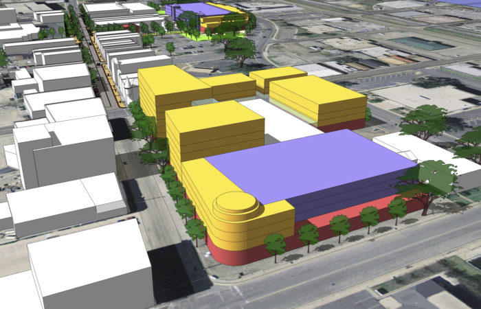
GEOGRAPHIC AREA HIGHLIGHT: Building A Sense Of Place – Lot D | Ellicott City’s historic core is dominated by a 288-space surface parking lot-Lot D-through which passes the channelized Tiber Branch. Flood mitigation projects will divert most of the flood waters away from this reach of the tributary, creating opportunities to reimagine this area.

BALANCING NEEDS AND OPPORTUNITIES | The plan seeks to maintain Lot D as a significant centrally-located parking resource, while preserving opportunities to create a significant public amenity coupled with potential infill mixed-use development. The plan outlines several different approaches to how Lot D can evolve over time as market conditions and needs warrant.


_Annapolis City Dock_Image (2)")